Surigao del Norte occupies the northeastern tip of Mindanao, curling around the Surigao Strait that separates the island from Leyte and Southern Leyte. It is a province of dramatic seascapes — the surfing break at Cloud 9 in Siargao is among the most famous in Asia — and a scattering of islands whose reefs and channels define life more than any road or provincial border.
Surigao CityCapital
1,973 km²Area
20 + 1 cityMunicipalities
MindanaoIsland Group
Siargao Island — technically part of the province, reached by plane from Cebu or Manila or by boat from Surigao City — is the Philippine surfing capital and one of the country's most visited island destinations. Its fame has reshaped the economic geography of the province in two decades.
★
The Surigao Treasure
In 1981, gold artefacts dating to approximately the 10th century CE were found in the municipality of Surigao — among the finest pre-colonial Philippine goldwork ever recovered. The Surigao Treasure, as it is known, includes items of extraordinary craftsmanship that demonstrate the sophistication of pre-Hispanic Philippine metalworking traditions. Most pieces are held in private collections internationally.
Surigao del Norte had 565,644 people in the 2024 census, in 20 towns and Surigao City. The province combines the northeastern tip of mainland Mindanao with Siargao, Bucas Grande and many smaller islands. Mangroves cover about 175 square kilometers of its coasts, and Nonoc Island holds one of the world's largest nickel deposits.
At the Strait
The Surigao Strait — the body of water between Surigao del Norte and Leyte — was one of the major maritime passages of the pre-colonial Philippines, used by traders moving between Mindanao and the Visayas. The communities at the narrowest point of the strait controlled the passage and profited from it. Spanish colonization brought the parish system and the galleon route but did not fundamentally change the maritime character of the Surigao communities.
1521
Rajah Siawi Meets Magellan
Rajah Siawi, a Surigaonon noble, met the Magellan expedition on Limasawa in 1521. Antonio Pigafetta described the rulers there as tattooed and wearing gold, and recorded the Surigao region as "Calagan".
1898
First Flag Raising in Mindanao
On 23 December 1898 the last Spanish governor of Surigao handed power peacefully to a Filipino provincial junta. According to the diary of the parish priest, Father Alberto Masoliver, the Philippine flag was raised over the Casa Real on 26 December, the first official flag raising in Mindanao.
1944
Battle of Surigao Strait
The Battle of Surigao Strait — fought on the night of 24–25 October 1944 — was the last battleship engagement in naval history and part of the broader Battle of Leyte Gulf. American naval forces destroyed the Japanese Southern Force attempting to pass through the strait to attack the Leyte beachhead. The wreck sites of several Japanese battleships and destroyers remain on the floor of the strait.
1960
Surigao del Norte Established
Republic Act No. 2786, approved on 19 June 1960, divided Surigao into two provinces, with Surigao as the capital of Surigao del Norte. The division recognized the distinct geography of the northern section — the archipelagic character of Siargao and the Dinagat Islands — from the mainland southern section that became Surigao del Sur.
1990s
Cloud 9 and the Siargao Cup
Cloud 9, a hollow right-breaking reef wave off General Luna, became known internationally in the 1990s. Surfer magazine named the Siargao surf trip one of the "Ten Best Surf Trips of All Time" in 1995, and the provincial government hosts the annual Siargao Cup there.
1995
Caraga Region
Republic Act No. 7901 of 23 February 1995 created the Caraga Administrative Region. Surigao del Norte moved into it from Northern Mindanao (Region X).
Surigao del Norte's culture is shaped by the sea. The Mamanwa people — among the oldest continuous inhabitants of Mindanao, classified as Negrito — maintain communities in the interior of the mainland. The coastal communities, predominantly Surigaonon-speaking, have a fishing and trading culture shaped by the strait and the archipelago.
Siargao Island Culture
Before surfing, Siargao was a coconut-farming island with fishing communities on its lagoon shores. The surf tourism of the past three decades has transformed the economy — surf camps, international restaurants, and accommodation along General Luna's beach road coexist with the fishing barangays and the coconut palms. The island navigates this coexistence with varying degrees of ease.
Bonok-Bonok Mananagat Festival
Surigao City's major festival — Bonok-Bonok Mananagat — celebrates the fishing tradition of the Surigaonon people with street dancing, boat parades, and cultural presentations. Mananagat means fisherman. The festival, held in August, is the province's largest annual event and a celebration of the maritime identity that has defined the Surigao coast for centuries.
★
Mamanwa People
The Mamanwa — a Negrito group living in the interior forests of Surigao del Norte and Agusan del Norte — are considered among the earliest inhabitants of Mindanao. Their language is classified in a separate branch from all surrounding languages. DNA studies suggest the Mamanwa's ancestors arrived in the Philippines before the Austronesian migration approximately 4,000 years ago.
The food of Surigao del Norte is built around what the sea provides — the Surigao Strait and the reef-studded waters around Siargao produce an extraordinary variety of fish, shellfish, and sea vegetables. The Surigaonon cooking tradition shares the Visayan and northern Mindanao approach: grilled fish, coconut milk preparations, and the kinilaw technique of vinegar-curing raw seafood.
Kiping (Surigao Kinilaw)
Fresh fish or squid cut into cubes and dressed with coconut vinegar, ginger, red onion, and local chilli. The Surigao version uses a locally produced coconut vinegar that is sharper and more aromatic than commercial vinegar. The freshness of the catch — the key variable in all kinilaw — is exceptional at the Surigao waterfront, where boats unload throughout the morning.
Larang (Fish in Coconut Milk)
A Surigaonon preparation of fresh fish — typically grouper or snapper — cooked in coconut milk with ginger, lemongrass, and local greens. The coconut milk is reduced to a thick, fragrant sauce. Eaten with steamed rice and a side of sautéed kangkong. This is the standard Sunday meal of the coastal barangays.
✦
Eating on Siargao
The restaurant scene on Siargao — concentrated in General Luna — covers the full range from local carinderia to international cuisine. For the best seafood, eat at the smaller establishments along the beachfront road in the morning. The catch is unloaded before dawn — by the time the international cafes open, the best fish is already in the local kitchens.
Surigaonon — the language of the Surigao coastal communities — is the primary language of the province. It belongs to the Visayan branch of the Philippine language family and is closely related to Cebuano, though distinct enough that speakers identify it as their own language rather than a dialect. Cebuano is widely understood and used in commerce.
SurigaononMain language
95.8%Speakers
Cebuano, WarayAlso spoken
Kamayo, MamanwaMinority
Surigaonon Identity
The Surigaonon linguistic and cultural identity is distinct from the Cebuano mainstream of the Visayas — the communities of the Surigao strait see themselves as northern Mindanao people, not Cebuanos, even though their language belongs to the same branch. The distinct intonation and vocabulary of Surigaonon mark a speaker immediately to Cebuano ears.
★
Mamanwa Language
The Mamanwa language of the interior forests is a separate language from Surigaonon. It is spoken by a small number of people, and language documentation efforts are ongoing. The Mamanwa maintain oral traditions in their language that encode knowledge of the Mindanao forest environment.
Surigao del Norte is accessible from Manila or Cebu — either by air to Surigao City or by the newer direct flights to Siargao's Del Carmen airport. Surigao City functions as the provincial gateway; Siargao Island is a 45-minute ferry ride from the city's port.
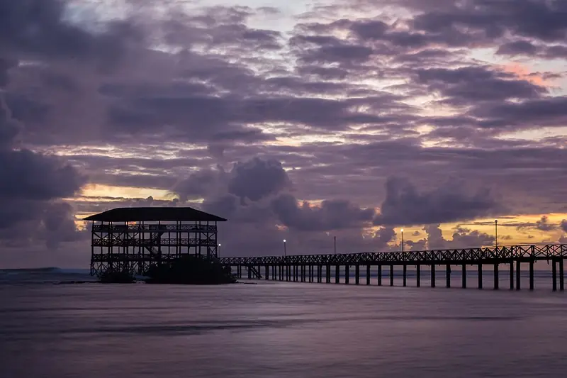
The reef break at Cloud 9 in General Luna is the centrepiece of Philippine surfing — a powerful barrelling wave that breaks over a shallow reef and produces the kind of ride that attracts competitive surfers from Australia, the Americas, and Europe. The Siargao Cup competition has been held here annually since the 1990s. The wooden walkway over the reef offers views of the break for non-surfers.
Sohoton Cove, Bucas Grande
A system of sea caves, lagoons, and mangrove channels on Bucas Grande Island — accessible by boat from Surigao City or from Siargao. Stingless jellyfish inhabit the lagoons of Tojoman Lake within the cove, allowing visitors to swim among them. The cave and karst formations are dramatic. A full day is required to see the system properly.
Naked Island, Naked Sandbar
Three sandbars off the northern coast of Siargao — Naked Island (a strip of white sand with no vegetation), Daku Island, and Guyam Island — form a standard island-hopping circuit from General Luna. The sandbars shift with the season. Daku is the largest and has shaded rest areas. The circuit takes a half day by bangka.
✦
Siargao in Peak Season
September to November brings the biggest surf and the most visitors to Siargao. Accommodation fills quickly — book six to eight weeks ahead for the Siargao Cup period. March to May is quieter, with smaller waves and calmer waters for island hopping. The lagoons and coves are best visited during the calm season.
Mangroves line much of Surigao del Norte's coast. On Siargao, the Del Carmen Mangrove Reserve covers about 4,871 hectares, more than half of the island's mangrove forest, and became a Ramsar wetland of international importance on 8 January 2024. Seagrass beds and coral reefs around the islands are still in relatively good condition. Sohoton Cove on Bucas Grande, entered through caves that are half-submerged most of the time and passable only at low tide, is one of the province's best-known natural sites.
On the night of October 24 to 25, 1944, the last battleship engagement in the history of naval warfare was fought in the Surigao Strait between Surigao del Norte and Leyte. The Japanese Southern Force — two battleships, a heavy cruiser, and four destroyers — attempted to pass through the strait to reach the American landing fleet at Leyte Gulf. The American Seventh Fleet was waiting for them.
The battle lasted a few hours. American PT boats and destroyers attacked first; then the battleships. The Japanese force was destroyed — the battleships Yamashiro and Fuso sunk, along with three destroyers. Only one Japanese ship escaped. Rear Admiral Masami Ban survived the sinking of his destroyer and was captured. The wreck of the Yamashiro lies approximately 170 meters beneath the surface of the strait.
The fishermen of Surigao today cross the strait daily on their bangkas. The water above the wrecks is the same water their grandfathers crossed when the guns were firing. On a clear morning, with the mountains of Leyte visible on the far side, it is a strait that looks exactly like what it was: a passage between islands that people have been crossing for thousands of years, and that one night became something else.
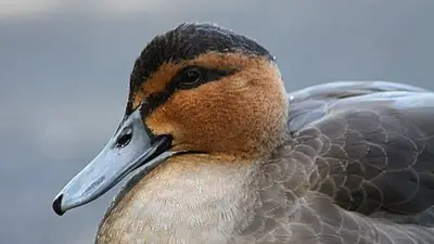
Philippine duck: IUCN Least Concern (BirdLife International 2025 assessment); 15,000–30,000 mature individuals; population appears to have stabilized — Wikipedia: Philippine duck (rev. 1351436886)
Photo credits (4)
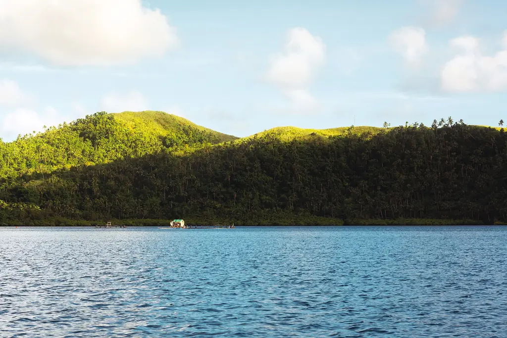
Green hills of Middle Bucas Grande across calm water, seen from Dapa — Photo: Michael Angelo Luna · CC BY-SA 4.0 · Wikimedia Commons