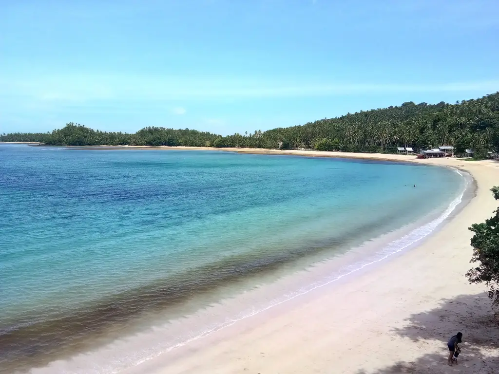
Surigao del Sur runs down the eastern coast of Mindanao — a long narrow province backed against the Caraga highland forests and facing the Philippine Sea with a coastline of white sand beaches, fishing communities, and the remarkably preserved marine environment of Bislig Bay. Its capital, Tandag City, sits at the midpoint of the coast.
Tandag CityCapital
4,933 km²Area
17 + 2 citiesMunicipalities
MindanaoIsland Group
The Agusan Marsh — one of the largest freshwater wetlands in Southeast Asia — extends into the interior watershed of Surigao del Sur from Agusan del Sur, while the coastal strip is defined by the Pacific-facing beaches, the tuna-rich waters offshore, and the old-growth dipterocarp forests of the Bislig area that represent the largest remaining lowland forest in the Philippines.
★
Bislig's Timber Legacy
Bislig City in southern Surigao del Sur was for decades the center of the Philippine timber industry — the Bislig Agro-Industrial Corporation (PICOP) operated one of the largest timber concessions in the country from its base here. The company town, the sawmills, and the forest roads are now largely idle, but the remnant old-growth forest in the Bislig watershed is among the most biodiverse in the country.
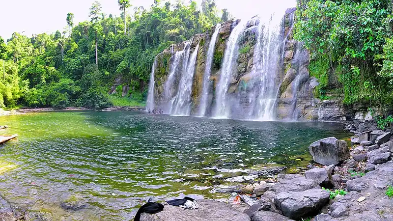
Surigao del Sur had 648,858 people in the 2024 census, in 17 towns and the cities of Tandag and Bislig. About two-thirds of its land is classified as forest land. Its best-known natural sights are Tinuy-an Falls in Bislig, a 95-meter-wide curtain of water said to be the widest waterfall in the country, and the Hinatuan Enchanted River.
The Caraga Frontier
The eastern coast of Mindanao was a frontier zone in the Spanish colonial period — too rugged and too far from Manila to be effectively administered from the Spanish centers at Cebu and later Manila. The coastal communities were gradually Christianised through the efforts of Augustinian Recollect missionaries from the 17th century onward, but the interior forests remained outside colonial control throughout the Spanish period.
1609–1622
Spanish Rule at Tandag
A large Spanish expedition imposed Spanish authority at Tandag in 1609, and Tandag became the seat of the old district of Caraga. Recollect missionaries arrived there in 1622 and set up a permanent mission.
1960
Surigao del Sur Established
Republic Act No. 2786, approved on 19 June 1960, divided Surigao into two provinces. Surigao del Sur began with 13 towns and Tandag as its capital, and Recaredo B. Castillo was its first governor. The long eastern coastal strip with its distinct forest and fishery resources was recognized as deserving separate administration. Tandag became the capital.
1960s
Logging Boom
Logging in the province's forests raised the province's income so quickly that within seven years of its founding it moved from fourth-class to first-class status.
1995
Caraga Region
Republic Act No. 7901 of 23 February 1995 created the Caraga Administrative Region, which now includes Surigao del Sur with the two Agusans, Surigao del Norte and the Dinagat Islands.
2007–2011
Tandag Becomes a City
Tandag's conversion into a city was ratified on 23 June 2007. Its city status was lost twice in court challenges and finally confirmed on 15 February 2011.
2021
Philippine Eagle Family at Tinuy-an
In March 2021, DENR and Philippine Eagle Foundation teams, guided by Manobo tribal members, confirmed a Philippine eagle nest with a chick in the forests of the Tinuy-an Falls Protected Landscape in Bislig. The pair had last been confirmed there in 2009.
Surigao del Sur's culture is shaped by the Manobo and Mandaya indigenous communities of the interior, the coastal Surigaonon communities, and the significant settler population from the Visayas that has shaped the lowland towns since the American period. The province has a strong Catholic identity in its urban centers and a living indigenous culture in its highland interior.
Mandaya People
The Mandaya — whose name means 'those who live upstream' — are the primary indigenous group of the eastern Mindanao highland interior, with significant communities in Surigao del Sur and neighboring Davao Oriental. The Mandaya are known for their inabal weave — a textile made from abaca fibre in geometric patterns that encodes clan and community identity — and for the ritual traditions maintained by the baylan, or spiritual specialist.
Surigao del Sur Festival
The Lusan Festival in Tandag City — held annually in August — celebrates the province's culture and heritage with street dancing incorporating indigenous Mandaya and Manobo motifs alongside the Christian community's own traditions. The festival brings together the province's diverse communities in a way that reflects the layered coexistence of highland and coastal cultures.
★
The Philippine Eagle in Surigao del Sur
The forests of Surigao del Sur's interior are among the recorded habitats of the Philippine Eagle — one of the largest eagles in the world and the Philippines' national bird. The old-growth forest remnants in the Bislig watershed and the Caraga highland provide the vast territory that each breeding pair of the eagle requires. Conservation work continues in partnership with highland indigenous communities.
Surigao del Sur's food reflects its position on the Philippine Sea coast — the waters off Tandag and Bislig are rich fishing grounds, and the daily catch drives a cuisine built on fresh seafood, coconut milk, and the vinegar preparations that characterise the Caraga Region's cooking tradition.
Inubaran na Isda
A Caraga preparation of fresh fish cooked in banana blossom (ubod) and coconut milk. The banana blossom is sliced thin and braised in the coconut milk with the fish, ginger, and local herbs until the sauce is thick and the blossom tender. The result is a dish that is both substantial and delicate — the coconut milk absorbing the flavours of the sea and the forest ingredient equally.
Puso ng Saging (Banana Blossom Preparation)
The banana blossom — abundant in the coastal barangays where banana palms grow at the forest edge — is used across the Caraga Region as a meat substitute in vegetable preparations. Braised with coconut milk and local vinegar, or simply sautéed with garlic and bagoong, the blossom takes on a texture and flavor that sustains the household through lean fishing days.
✦
Tuna from the Philippine Sea
The waters off Surigao del Sur's eastern coast are part of the same tuna-rich zone that supplies General Santos and the broader CARAGA Region. Fresh yellowfin and skipjack tuna are available at the Tandag fish market in the morning. The grilled tuna preparation here — over coconut shell charcoal, served with a dipping vinegar — is the local standard.
Surigaonon and its Tandaganon variety are spoken in most of Surigao del Sur. In Bislig and the towns of Barobo, Hinatuan, Lingig and Tagbina, most people speak Cebuano, and Kamayo, a separate language distantly related to Surigaonon, is spoken by many others. The highland interior communities speak Manobo languages. Filipino and English are used in schools and government.
SurigaononMain language
Cebuano, KamayoSouth
ManoboHighlands
Filipino, EnglishSecond languages
Mandaya Language
Mandaya is spoken mainly in eastern Mindanao. The language encodes a detailed knowledge of the Mindanao highland environment through its plant, animal, and landscape terminology.
★
The Baylan Tradition
The baylan of the Mandaya and Manobo communities — a ritual specialist who serves as intermediary between the human and spirit world — maintains a specialized ritual language used in healing ceremonies and community rituals. This language, distinct from everyday Mandaya or Manobo, is transmitted through apprenticeship and not generally known by the wider community.
Surigao del Sur is reached by road from Surigao City in the north — a coastal drive of about three hours to Tandag — or by road from Davao through the interior Caraga highway. There is a small airport in Tandag City with limited service. Bislig in the south has its own access road from the Davao corridor.
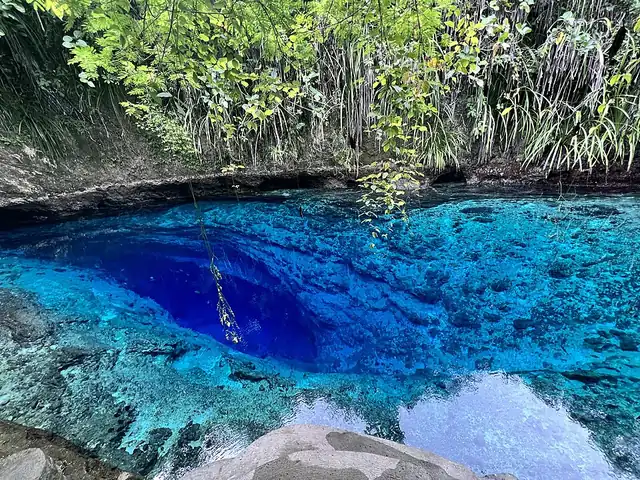
One of the most photographed natural sites in the Philippines — a short river of extraordinary blue-green clarity that flows from a series of underwater caves into the sea at Hinatuan municipality. The color of the water is produced by the depth and the limestone formations of the underwater cave system. Twice daily, a fish feeding ritual draws hundreds of marine fish into the freshwater channel from the sea.
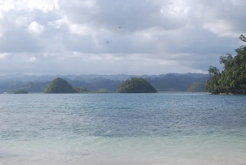
A group of small islands off the coast of San Agustin municipality, accessible by boat from the town port. White sand beaches, clear water, and a manageable scale — the island group can be covered in a day by bangka. The islands are relatively undeveloped; accommodation is basic and limited.
A wide multi-tiered waterfall in Bislig City — often called the Niagara of the Philippines for its broad curtain of water. The falls cascade over rock terraces in the forest. There is a bamboo raft for approaching the base of the falls through the spray. The surrounding forest is part of the Bislig watershed.
✦
Enchanted River — Arrive Early
The Enchanted River at Hinatuan draws large numbers of visitors, particularly at weekends. Arrive before 9am to see the river at its most serene. The fish feeding happens at noon and 5pm — the noon feeding is the more dramatic, with hundreds of large saltwater fish pushing upstream from the bay. The entry fee supports the local barangay.
About two-thirds of Surigao del Sur's land is classified as forest land, and much of the remaining lowland forest is around Bislig. In 2024, the American birder Peter Kaestner saw his 10,000th bird species at Tinuy-an Falls, a world record. Hinatuan Bay, at the mouth of the Enchanted River, is a habitat for sea turtles. Tinuy-an Falls itself is co-managed by the Bislig tourism office and the Manobo Tribal Council.
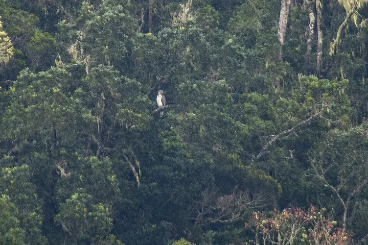
The national bird. A pair in the Bislig forests was first seen in 2007, and in March 2021 a nest with a two-month-old chick was confirmed inside the Tinuy-an Falls Protected Landscape, with help from Manobo guides.
Field note: Keep far from nests and report sightings to DENR Caraga or the Philippine Eagle Foundation.
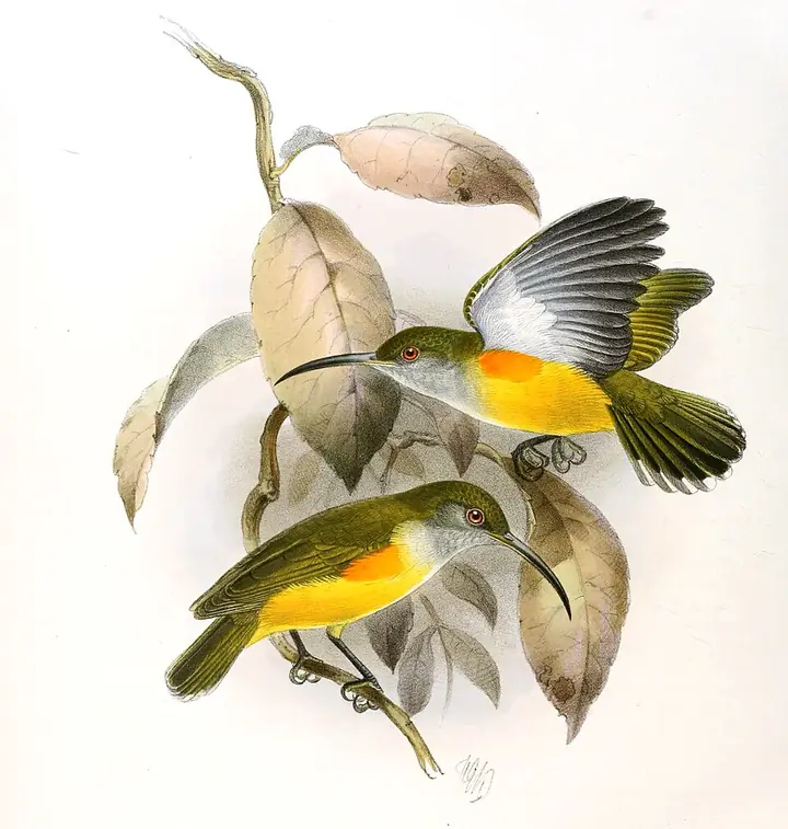
A small olive bird with a long curved bill that feeds on nectar, especially from banana and heliconia flowers. One seen in a heliconia thicket at Tinuy-an Falls in 2024 was Peter Kaestner's record-setting 10,000th species.
The Hinatuan Enchanted River is not, strictly speaking, a river. It is the surface expression of an underwater cave system — a place where an aquifer meets the sea and the water emerges with the clarity of something that has been filtered through limestone for a very long time. The blue is not metaphorical. It is the blue of extreme depth and extreme clarity simultaneously: water you can see through to ten meters and that makes ten meters look like three.
The fish come from the sea. Twice a day, the current reverses — or something changes — and saltwater fish of considerable size push upstream into the freshwater channel and wait. The local community feeds them. The fish are not domesticated in any conventional sense, but they have learned that the feeding will happen, and they come for it. Marine biologists have not fully explained what the fish are doing in freshwater. The community has its own explanation, encoded in the name they gave the river: enchanted.
In a country where almost every remarkable natural feature has been given a romantic explanation, the Enchanted River is one that resists comfortable categorisation. The science is real but incomplete. The fish behavior is observed but not fully understood. The blue of the water is both beautiful and slightly unsettling — the color of something that comes from deeper than you can see.