Zambales runs along the western coast of Luzon, facing the South China Sea with a long narrow strip of land backed by the Zambales Mountains. It is the province where Mount Pinatubo rises — the volcano whose 1991 eruption was the second-largest land eruption of the 20th century — and where the Aeta people have lived in the mountain forests since long before Spanish times.
IbaCapital
3,831 km²Area
13 + 1 cityMunicipalities
LuzonIsland Group
The province stretches from the Subic Bay area in the south — where the former US naval base has become a freeport and economic zone — to the mango-producing municipalities of the north, where Zambales mangoes are considered among the finest in the Philippines. Between them, the lahar plains left by the 1991 Pinatubo eruption continue to reshape the landscape.
★
The Zambales Mango
The carabao mango grown in the northern municipalities of Zambales — particularly in San Felipe and the towns around Iba — is widely regarded as some of the best mango in the Philippines. The Zambales variety is characterised by its sweetness, fibre-free flesh, and the thin skin that peels cleanly from the fruit.
The 2024 census counted 946,128 people in Zambales, including the highly urbanized city of Olongapo, which lies within the province but governs itself. The province has 13 municipalities, with Iba as the capital. Its name comes from "Zambales", the Spanish form of the name of the Sambal people, the region's original dominant group.
Aeta and the Mountain Interior
The Aeta people of the Zambales Mountains are among the oldest continuous inhabitants of Luzon — classified as Negrito, their ancestors are believed to have arrived in the Philippines before the Austronesian migration approximately 30,000 years ago. The Aeta have lived in the forests of the Zambales Mountains, the slopes of Pinatubo, and the Cordillera foothills for as long as any record or oral tradition reaches.
1572
Salcedo Explores the Coast
Spanish forces under Juan de Salcedo explored the Zambales coast in 1572. Off Cape Bolinao, now in Pangasinan, they freed a Zambal chieftain and his followers from a Chinese pirate ship.
1607
Masinloc and Subic Founded
Masinloc and Subic, founded in 1607, were among the earliest towns, followed by Iba in 1611. Masinloc was the first capital; the seat moved among the early towns before settling in Iba.
1885
Arsenal de Olongapo
After a royal decree made Subic Bay a naval port in 1884, the Spanish Navy authorized the Arsenal de Olongapo in March 1885. The Americans took over the yard in December 1899, and the base grew into U.S. Naval Base Subic Bay.
1901
Civil Government
Potenciano Lesaca became the first civil governor of Zambales under American rule, serving from 1901 to 1903.
1991
Mount Pinatubo Eruption
Mount Pinatubo, whose summit and crater lake lie in Botolan, erupted on 15 June 1991. It was the second-largest land eruption of the 20th century. Early warnings led to the evacuation of tens of thousands of people, which saved many lives.
1992
Subic Base Closes
U.S. Naval Base Subic Bay closed in 1992, and the government turned it into the Subic Bay Freeport Zone.
Zambales's cultural identity is divided between the coastal municipalities — Catholic, Spanish-colonial-heritage, fishing and farming — and the mountain interior, where the Aeta maintain communities and cultural practices of their own. The former US bases at Subic and Olongapo have added a further layer of American influence to the southern portion of the province.
Aeta Culture and the Pinatubo Diaspora
The 1991 Pinatubo eruption dispersed the Aeta communities that had lived on the volcano's slopes for generations. Many were relocated to evacuation centers and resettlement areas in the plains. The relocation — intended as temporary — became permanent for many communities. The Aeta who have remained near the mountain — now visiting the crater lake and guides for trekking tours — maintain a connection to the landscape that the eruption did not extinguish.
Subic Bay Freeport
The former US Naval Station Subic Bay was converted into the Subic Bay Freeport Zone following the American departure in 1992. The transformation of a military base into a commercial, industrial, and tourism zone — the infrastructure reused, the housing occupied by Filipino families, the piers now serving cargo ships, turned the old base into one of the country's main economic zones.
★
The Subic Monkeys
The forests of the Subic Bay freeport are home to long-tailed macaques. The macaques often wander onto the freeport roads and into residential areas. Do not feed them.
Zambales's food is defined by its two signature products: the mango from the northern farms and the seafood from the South China Sea coast. The cuisine is broadly Ilocano in the north — fermented fish paste, vegetable-forward cooking — and Kapampangan-influenced in the south. The Subic area has developed an international food scene owing to the freeport zone's diverse population.
Zambales Carabao Mango
The mangoes of northern Zambales — consumed fresh, made into preserves, dried, or processed into juice and pastilles — are the province's most celebrated product. Eaten ripe with the skin peeled back from the seed, the flesh is sweet, smooth, and deeply aromatic. In season (roughly January to April), road stalls along the national highway sell them by the kilo for a fraction of the Manila price.
Adobong Damulag (Carabao Adobo)
Carabao meat — tougher than beef and with a distinct flavor — cooked in the adobo manner: vinegar, soy sauce, garlic, bay leaf, and black pepper, braised long and slow until tender. A working-class preparation from the farming municipalities, where carabao were the primary draft animals and occasionally the source of meat for feast days.
✦
Buying Mangoes in Zambales
Mangoes are most abundant from January to April. Buy from roadside stalls between Olongapo and Iba for the best price. Look for fully ripe fruit with a slight give when pressed — the Zambales carabao mango is best eaten immediately, not after further ripening at room temperature.
Sambal — the language of the indigenous Zambal coastal people — is spoken in several municipalities of the province, though it has been largely displaced by Tagalog and Ilocano over the past century. Tagalog is the primary language of communication in most of the province. Ilocano is the mother tongue of the northern municipalities. The Aeta of the mountains speak their own Sambalic languages, such as Mag-Antsi and Mag-Indi.
TagalogMost spoken
IlocanoNorth
SambalNative
Mag-Antsi, Mag-IndiAeta
Sambal Language
Sambal is a Central Luzon language, cited in 2000 with about 70,000 native speakers, and is classified in the Sambalic branch alongside Bolinao and Botolan. The language has several dialects and has been under pressure from Tagalog for over a century. The Zambal identity — associated with the coastal communities of the province's namesake people — is distinct from the Ilocano settler communities of the northern interior.
★
Aeta Languages
The Aeta of the Zambales Mountains speak languages of the Sambalic branch, such as Mag-Antsi and Mag-Indi. The Aeta of Zambales have received a Certificate of Ancestral Domain Title covering the Zambales side of Pinatubo, including the summit and Lake Pinatubo.
Zambales is two to three hours from Manila — accessible via the SCTEX expressway to Olongapo and then north along the coastal highway. The province is easily reached for a weekend visit. Subic Bay is the most developed tourism entry point; the rest of the province rewards a slower coastal drive north.
2–3 hrs (SCTEX to Olongapo)From Manila
Capas or San Marcelino accessPinatubo trek
January–AprilMango season
Nov–MayBeach season
Mount Pinatubo Crater Lake
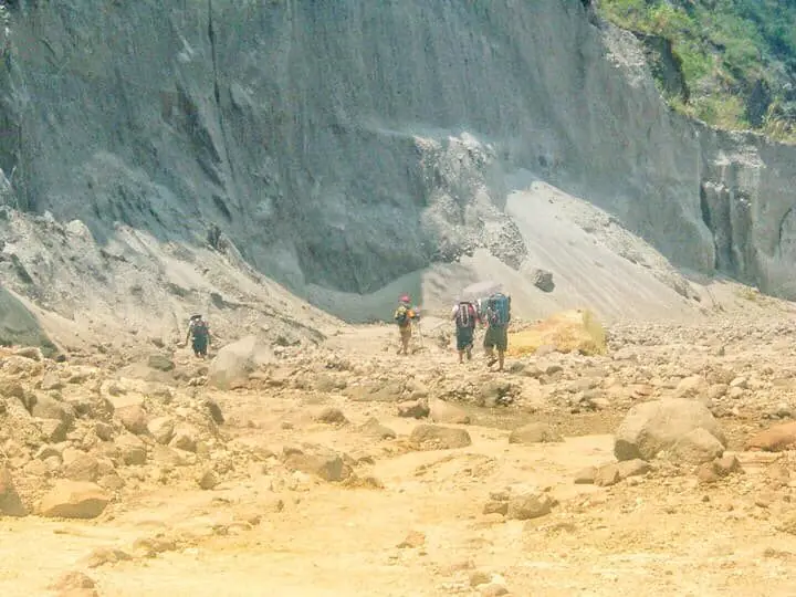
The crater lake of Mount Pinatubo — formed after the 1991 eruption in the collapsed caldera — lies in Botolan, near the meeting point of Zambales, Pampanga and Tarlac, and has become a popular trekking destination. The approach requires a 4WD vehicle or habal-habal through the lahar fields, followed by a hike to the crater rim. The lake's color shifts from turquoise to green depending on the season. The landscape of the lahar plains on the approach is otherworldly.
Subic Bay Freeport
The former US Naval Station converted into an economic and tourism zone — with a beach resort, yacht club, zipline operations in the forest, and the infrastructure of a former military base repurposed for commerce and leisure. The Subic Bay Museum documents both the naval history and the ecological restoration of the bay.
Anawangin and Nagsasa Coves
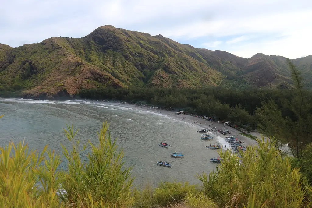
Remote coves accessible only by boat from Pundaquit in San Antonio municipality — beaches of gray volcanic sand with agoho pines growing from the Pinatubo ash deposits. The gray sand and the pine trees create a landscape that looks nothing like a typical Philippine beach. No electricity, no permanent structures. Camping is the standard overnight arrangement.
✦
Pinatubo Trek — Book in Advance
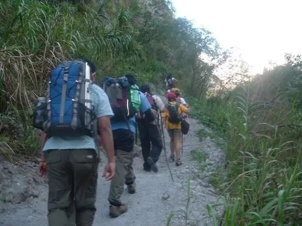
The Mount Pinatubo trek requires a permit and a local guide from the municipalities of Capas (Tarlac) or San Marcelino (Zambales). The trek is best attempted in the dry season — March to May — when the lahar fields are passable and the crater lake is accessible. Book through accredited tour operators at least a week in advance during peak season.
Mount Tapulao, also called High Peak, is the highest mountain of the Zambales range at 2,044 meters, in the municipality of Palauig. Its trail climbs from grassland through dipterocarp and mossy forest to pine forest above about 1,800 meters; its name comes from tapolaw, the Sambal word for the pines. Old chromite mine pits still scar the summit. The massif continues east into Tarlac, where its forests became the Mt. Sawtooth Protected Landscape in 2025.
Tapulao Shrew-rat
Rhynchomys tapulao
Data Deficient
A shrew-rat named after Mount Tapulao and described by scientists in 2007. Too little is known about it for the IUCN to assess its status.
Field note: Stay on trails in the mossy forest and leave logs and leaf litter undisturbed.
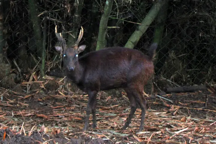
The Philippine brown deer, a forest deer found only in the Philippines. It is among the threatened species recorded in the Mt. Sawtooth forests on the Tarlac side of the Tapulao massif.
Field note: Hunting it is illegal. Report snares and venison sales to the DENR.
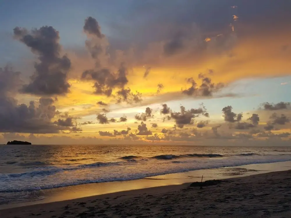
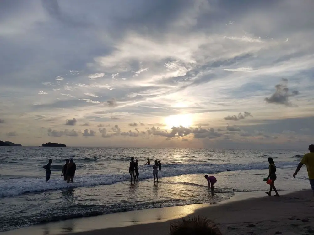
Pundaquit is a quiet coastal barangay in San Antonio, Zambales, and it wins you over with calm rather than noise.
There are no bars or nightlife here, and that is the point. Rolling waves, fine gray sand, and clean water make it a place to breathe out. At three to four hours from Manila, it is even closer than La Union.
Pundaquit is also the jumping-off point for the islands of Anawangin, Capones, and Potipot, each its own reason to come back.
Mount Pinatubo is an active volcano in the Zambales Mountains, on the meeting point of Zambales, Tarlac, and Pampanga.
In June 1991 it erupted in one of the largest blasts of the twentieth century, reshaping the land for miles and burying it in ash and lahar. In the years since, rainwater has filled the crater to form a lake.
Standing at the rim, it is hard to believe such calm beauty came from such destruction. The crater lake is a sheet of green under a high sun, the land around it carved into peaks and folds. A beautiful disaster.
Name from the Sambal; Salcedo 1572; Masinloc and Subic 1607, Iba 1611; Masinloc first capital; Lesaca 1901–1903; Subic Bay base closed 1992; mangoes abundant January–April; Pinatubo summit in Botolan; Olongapo independent — Wikipedia: Zambales (rev. 1375707697)
15 June 1991 VEI-6 eruption, second-largest terrestrial eruption of the 20th century; evacuations; Lake Pinatubo; Aeta CADT over the Zambales side — Wikipedia: Mount Pinatubo (rev. 1369580869)