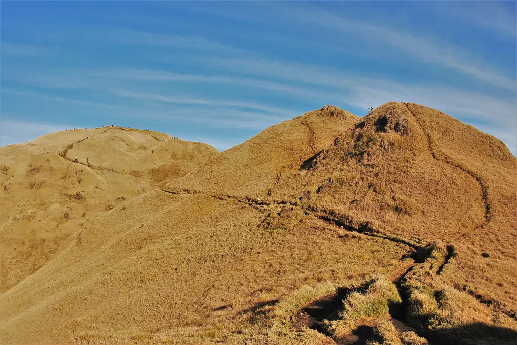
Grassland ridges of Mount Pulag National Park, Benguet
Photo: Say Bernardo · CC BY-SA 4.0 · Wikimedia Commons
Map

Benguet

Cordillera Administrative Region
Luzon
Capital La Trinidad
Population (2024) 841,616
Area 2,827 km²
Municipalities 13
Cities 1
Island Group Luzon
Languages Kankanaey, Ibaloi, Tagalog

Population: 2024 census (PSA). Area: land area. Population, area and city count include Baguio, which the census lists separately from the province.

Kapitbahay — Neighboring Provinces

Benguet is the southern gateway to the Cordillera mountains, wrapping around Baguio City — the Summer Capital of the Philippines — without including it administratively. The province is defined by elevation: its municipalities sit at altitudes that make possible strawberries, temperate vegetables, cut flowers, and the gold mining operations that have shaped the Cordillera economy for over a century.

La TrinidadCapital
2,769 km² (2,827 with Baguio)Area
13 (Baguio is independent)Municipalities
LuzonIsland Group

La Trinidad, the capital, sits in a valley immediately north of Baguio City. The Benguet strawberry — cultivated across the valley's farms and marketed throughout Luzon — is harvested here. The town's strawberry farms are now a tourist attraction in their own right, with visitors paying to pick fruit directly from the rows.

★
Surrounds the Summer Capital

Baguio City is administratively independent from Benguet, but it is physically surrounded by the province on three sides. The relationship between Baguio and Benguet is one of the more complex provincial arrangements in Luzon — the city depends on Benguet for agricultural products, water, and labor, but has its own government and budget.

The Kankanaey and Ibaloi are the primary indigenous peoples of Benguet. The Ibaloi are historically associated with gold — the Cordillera gold trade predates the Spanish by centuries, and Ibaloi communities have maintained relationships with the mines, sometimes as workers, sometimes as opponents of corporate extraction, for generations.

The 2024 census counted 473,190 people in Benguet's 13 municipalities, making it the most populous province of the Cordillera Administrative Region; counting Baguio City, which lies inside the province but has governed itself since its 1909 charter, the figure is 841,616. The province covers 2,769 square kilometers at the southwestern tip of the Cordillera, or 2,827 with Baguio. Its name is a Hispanicized form of benget, the Kankanaey word for "edge", once the name of a settlement at the edge of a swamp formed by the Balili River in the La Trinidad valley. Benguet is called the Salad Bowl of the Philippines: the La Trinidad Vegetable Trading Post is the hub of the highland vegetable trade, and the barangay of Bahong in La Trinidad is known for its roses. Kankanaey people live mostly in the northwestern towns, Ibaloi in the southeast and Kalanguya in the east.
Benguet's history is inseparable from gold. Pre-colonial Ibaloi communities traded gold with lowland traders who brought it to the coastal ports and into the wider Southeast Asian commodity networks. The Spanish knew about Cordillera gold and from 1572 made repeated attempts to control the mines, none of which succeeded. It took the Americans to establish systematic mining extraction.

1572–1624

Spanish Expeditions

In 1572 the conquistador Juan de Salcedo led a small expedition into southern Benguet in search of its gold, but the people forced it to retreat. Spanish expeditions entered the La Trinidad valley in 1620, 1623 and 1624, the last attempt to take the gold mines for two centuries.

1829–1854

Galvey and the Comandancia

Expeditions under Colonel Guillermo Galvey from 1829 to 1839 finally gave Spain a foothold in the La Trinidad valley, which was named after his wife. The area became a district of the new province of La Montañosa in 1846 and a separate politico-military command, the Comandancia of Benguet, in 1854.

23 November 1900

American Civil Government

Act No. 48 of the Philippine Commission set up a civil government in Benguet, with the Canadian journalist H. P. Whitmarsh as its first governor. In 1903 the Benguet Consolidated Mining Company, now Benguet Corporation and the oldest mining company in the country, was founded and began mining gold in Itogon.

1903–1905

Kennon Road

Work on the Benguet Road from Rosario, La Union, up the Bued River canyon to Baguio began in 1903; it opened on 29 January 1905 and was later renamed for its builder, Colonel Lyman W. V. Kennon of the U.S. Army Corps of Engineers. It cost the colonial government more than US$2.7 million and was one of the most difficult engineering projects of its day.

1908–1909

Sub-province and City

Act No. 1876 of 18 August 1908 made Benguet a sub-province of the new Mountain Province. In 1909 Baguio received its own city charter and became independent of Benguet, although it lies inside the province.

18 June 1966

Province of Benguet

Republic Act No. 4695 split the old Mountain Province into four provinces: Benguet, Mountain Province, Ifugao and Kalinga-Apayao. La Trinidad became the capital of the new Benguet.

16 July 1990

Luzon Earthquake

At 4:26 p.m. a magnitude 7.8 earthquake on the Philippine Fault struck Luzon, killing 1,621 people. In Baguio 28 buildings collapsed, among them the Hyatt Terraces hotel, landslides closed Kennon Road and the other routes for days, and Benguet Corporation miners were among the first rescuers.

Anti-mining activism in Benguet has been persistent since the 1970s. Indigenous communities whose ancestral lands cover mine sites have fought — sometimes violently, often legally — to assert rights over their territory. The issue remains unresolved.

The Ibaloi are the indigenous people most associated with lower Benguet and the areas closest to Baguio. Historically, the Ibaloi were known for the practice of mummification — preserving their dead through smoking and then placing them in sitting position in burial caves. Many of these mummies lie in caves in Kabayan; the Kabayan Mummy Burial Caves were declared National Cultural Treasures in 1973, and the National Museum keeps a branch in Kabayan.

The Kankanaey

The Kankanaey inhabit the higher elevations of Benguet and much of Mountain Province. They are known for the dap-ay system — the traditional men's house and council space where community governance, rituals, and education of young men took place. The dap-ay is a physical expression of a democratic community structure that operated without formal chiefs.

★
Bodong Peace Pact

The bodong, a binding peace pact between communities, is an institution of the Kalinga to the north; by the start of the American period the neighboring Bontoc and Gaddang had begun adapting it. In Benguet, Ibaloi and Kankanaey communities settled disputes through councils of elders, and rituals were led by priests called mambunong.

Mining and Indigenous Rights

The conflict between Cordillera mining interests and indigenous land rights has defined Benguet's political life for decades. The Chico River dam campaign of the 1970s and 1980s, which successfully stopped a dam that would have flooded ancestral Kalinga territory, produced a model for indigenous resistance that communities in Benguet have drawn on in their own fights against mining expansion.

See the great festivals in Pista ng Pilipinas →

Benguet's highland climate makes possible foods unavailable in the lowlands: strawberries, temperate vegetables (lettuce, broccoli, cabbage, carrots), and cut flowers. The province supplies a significant portion of Luzon's fresh vegetable market. Local cooking reflects this abundance of cool-weather produce alongside the Cordillera staples of smoked pork and root crops.

Pinikpikan

A ceremonial chicken dish made by beating the live chicken before slaughtering it — a practice rooted in Cordillera ritual that activates the bird's blood under the skin, producing a distinct flavor when cooked. The chicken is then singed over a flame, boiled with etag (smoked salt-cured pork), and served as a broth. Pinikpikan is traditionally made for ritual occasions, not daily eating. The practice is controversial, and a number of communities now make a secular version using ordinary slaughtered chicken.

Etag

Salt-cured, smoked pork — the Cordillera's signature preserved meat. Etag has an intense, complex flavor from the salt cure and smoking process. It is used as a flavoring in soups and stews as much as eaten on its own. In Sagada and parts of Benguet, etag-flavored vegetables are a staple.

Dinengdeng with Benguet Vegetables

Benguet / Cordillera
15 minutesPrep
20 minutesCook
4Serves
Ingredients
  • 4 tbspbagoong isda (fermented fish paste)
  • 2 pieces, any varietygrilled or fried fish
  • 1 cup, cutsitaw (string beans)
  • 1/2 cuppatani (lima beans)
  • 2 cups, choppedpechay or mustard greens
  • 1 small, slicedampalaya (bitter melon)
  • 2 medium, slicedtomatoes
  • 1 medium, slicedonion
  • 4 cupswater
  • 1-inch knob, slicedginger
Method
  1. Bring water to a boil with bagoong isda, onion, tomatoes, and ginger. Simmer 5 minutes.
  2. Add harder vegetables first: patani and sitaw. Cook for 5 minutes.
  3. Add ampalaya and cook for 3 minutes.
  4. Add leafy greens and cook until just wilted.
  5. Add grilled fish and adjust flavor with additional bagoong if needed.
  6. Serve immediately with rice.
Cook's note

Dinengdeng is an Ilocano vegetable broth dish that Benguet cooks have adapted to highland produce. The bagoong provides salt — taste before adding anything extra. The vegetables should retain some texture.

Benguet has two primary indigenous languages: Ibaloi (spoken in lower Benguet and the areas closest to Baguio) and Kankanaey (spoken in the higher municipalities). Both are Cordilleran languages, but on different branches: Ibaloi belongs to the Southern Cordilleran group with Pangasinan, which it closely resembles, while Kankanaey is Central Cordilleran, alongside Bontoc and Ifugao. Kalanguya, spoken in the east of the province, is another Southern Cordilleran language.

Kankanaey, Ibaloi, KalanguyaMain languages
~240,000 (1990 census)Kankanaey speakers
~120,000 (2005)Ibaloi speakers
Ilocano; also Filipino, EnglishLingua franca
★
Ilocano Presence

Ilocano is widely spoken across Benguet as a lingua franca, reflecting centuries of trade and migration between the Ilocos coast and the Cordillera highlands. Many Benguet residents are bilingual or trilingual in their indigenous language, Ilocano, and Filipino.

Baguio City's influence on Benguet's linguistic landscape is significant. The city is multilingual — Tagalog, Ilocano, Kankanaey, Ibaloi, and English are all in use — and that multilingualism extends into surrounding Benguet municipalities. Young people in La Trinidad and Baguio's surrounding barangays often use Tagalog as their primary language.

English is strong in Benguet, particularly in areas connected to the university and mining sectors. The University of the Cordilleras and Benguet State University, both in the Baguio-La Trinidad area, maintain significant English-medium instruction.

Benguet is visited primarily through Baguio City, which serves as the base for most highland Luzon travel. La Trinidad's strawberry farms are a standard day trip from Baguio. The province's own municipalities — Kabayan, Bokod, Kibungan — require more effort and reward it with less crowded landscapes.

~5 hrs by bus to Baguio; no airport in BenguetFrom Manila
Loakan Airport, Baguio (limited service)Nearest Airport
November to AprilBest Season
November to May in La TrinidadStrawberry Season

Strawberry Farm, La Trinidad

The valley floor of La Trinidad is planted in strawberries from November through May. Visitors pay an entrance fee and pick their own fruit. The experience is straightforward but the strawberries, eaten immediately after picking, are exceptional — sweeter and more fragrant than anything transported to a market.

Kabayan Mummy Caves

The municipality of Kabayan holds several burial caves containing Ibaloi mummies — among the oldest and best-preserved in the Philippines. The caves are now protected, and visits require permits and registered guides. The National Museum protects the Timbac burial caves and the mummy rocks of the area, and its Kabayan branch displays mummies and objects from Ibaloi death rites.

Mt. Pulag National Park

The highest peak in Luzon and the third-highest in the Philippines, at 2,928 meters, straddling Benguet, Ifugao, and Nueva Vizcaya. The summit is above the cloud line and frequently accessible through a sea of clouds at sunrise. The grassland summit and mossy forest below are designated protected areas. Permits are required and must be arranged through the DENR.

✦
Mt. Pulag Permits

Mt. Pulag permits must be obtained from the PAMB office in Ambangeg, Bokod. Permits sell out during peak season (December–February). Book well in advance. The trail system has several routes; the Ambangeg trail is the easiest and most used.

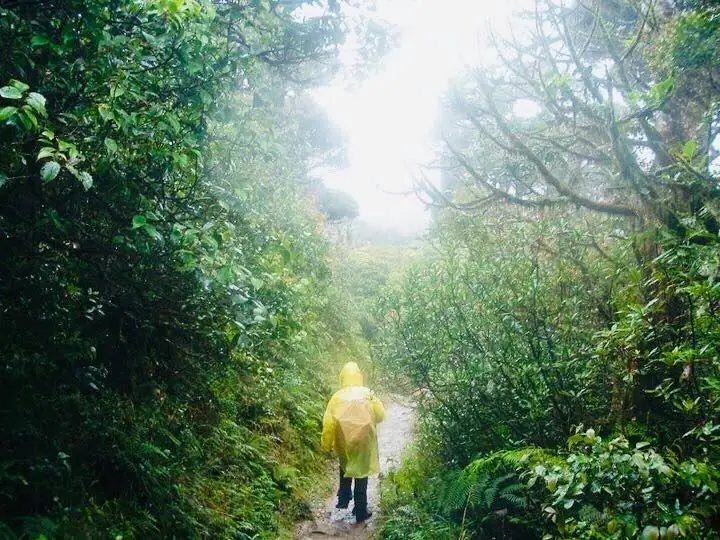
Benguet sits at the southern end of the Cordillera Central, and almost all of it is mountain. Mount Pulag in Kabayan, at 2,928 meters the highest peak in Luzon and the third highest in the Philippines, stands where Benguet meets Ifugao and Nueva Vizcaya; it was proclaimed a national park on 20 February 1987, covering 11,550 hectares, and is known for its mossy montane forest, its grassland summit and the sea of clouds at dawn. The province's mountains are the headwaters of the Agno, Amburayan, Bued, Bakun, Balili and Asin rivers, and its largest conservation areas are the Upper Agno River Basin Resource Reserve, Mount Pulag National Park, Mount Data National Park and the Lower Agno Watershed Forest Reserve. Lower slopes are covered by open forests of Benguet pine, the dominant tree of the Luzon tropical pine forests. Fire is a constant risk in the dry months: in January 2018 trekking on Mount Pulag was suspended after a fire, reportedly started by a hiker's butane stove, burned part of the mountain.

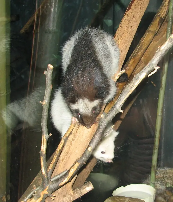
A northern Luzon giant cloud rat (photographed at Cincinnati Zoo, USA)
Photo: Ltshears · CC BY 3.0 · Wikimedia Commons
Northern Luzon Giant Cloud Rat
Phloeomys pallidus
Least Concern
One of the largest rodents in the world, 75 to 77 centimeters long including its furry tail and weighing up to 2.6 kilograms. It lives in the forests of northern Luzon, feeds on leaves at night, and is completely harmless; its fur is usually pale with dark patches, often with a black mask.
Field note: Hunting and forest loss are its main threats. Report captive animals offered for sale to the DENR.
Luzon Fruit Bat
Otopteropus cartilagonodus
Least Concern
A tiny fruit bat, the only species in its genus, found only on Luzon. It is most common in montane primary forest from about 200 to 2,250 meters but also lives in well-developed secondary and mossy forest, where it helps spread seeds.
Benguet Pine
Pinus kesiya
Least Concern
Named for this province, where it is the dominant tree of the Luzon tropical pine forests; in Ilocano the pine is called saleng. The species ranges from the Khasi Hills of northeast India to the Philippines.
Field note: Never leave an open flame on pine slopes; dry-season fires spread fast.
Meet all 65 Philippine animals in Hayop ng Pilipinas →
← All stories
Kultura · La Trinidad

The Colors of StoBoSa

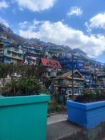
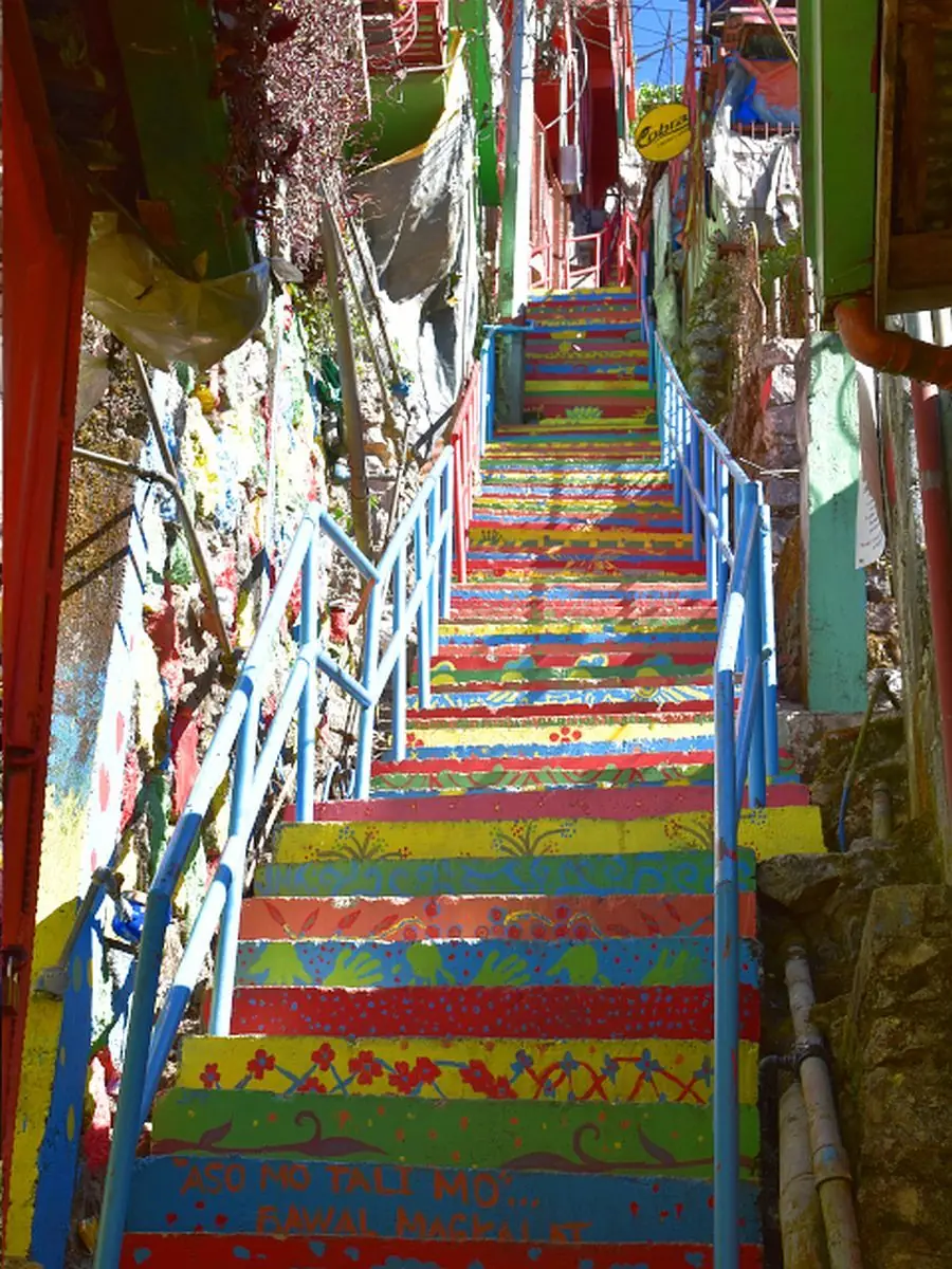
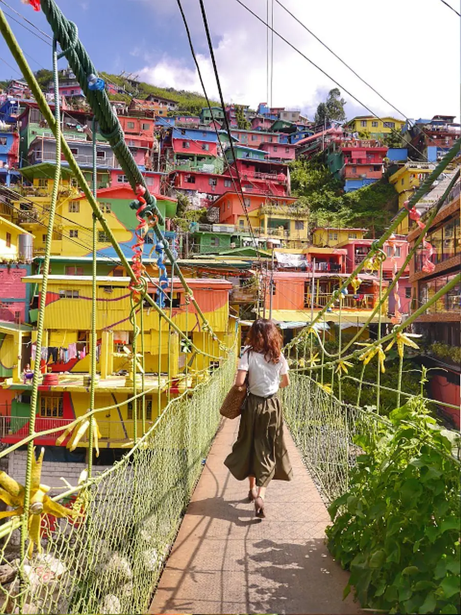
Above the highway in La Trinidad, Benguet, a whole hillside of houses has been turned into a giant painting. This is the Colors of StoBoSa, named for the sitios of Stonehill, Botiwtiw, and Sadjap in Barangay Balili.

Once a plain cluster of concrete homes, the hillside was transformed in 2016 by the artists of Tam-awan Village and the Chanum Foundation, led by the solar artist Jordan Mang-osan, with support from the Department of Tourism. Around 500 residents and volunteers joined in, and it took roughly 1,800 gallons of paint to cover the homes.

Inspired by the painted favelas of Brazil and a culture village in Busan, South Korea, the mural turned what many once called an eyesore into one of La Trinidad's most photographed sights. It is best seen in the dry months, from November to April, and easy to reach from Baguio.

Mga Larawan

← All stories
Lugar · Benguet

Mount Pulag, Roof of Luzon

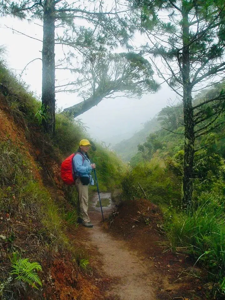
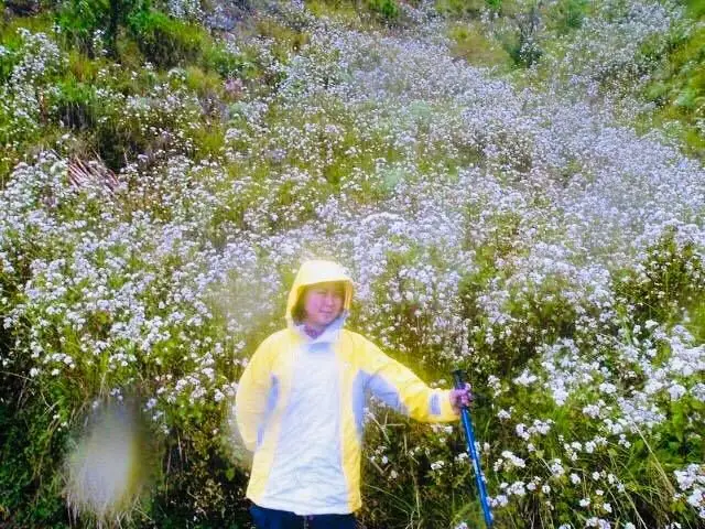
Mount Pulag is the highest mountain in Luzon and the third highest in the Philippines, rising to 2,928 meters. Its summit sits where Benguet, Ifugao, and Nueva Vizcaya meet.

Climbers come for the famous sea of clouds at dawn, the mossy montane forest, and the grassland summit with its dwarf bamboo. There are four main trails, and the Ambangeg trail from Benguet is the gentlest, the one I took on my first major climb.

I was not lucky with the clouds that day, and the cold nearly beat me, dropping to about minus two degrees. Even so, standing near the roof of Luzon is something you do not forget.

Mga Larawan

Sources · updated 4 October 2026
Photo credits (2)

Photos from Wikimedia Commons, used under the licences shown; some were resized. All photo credits